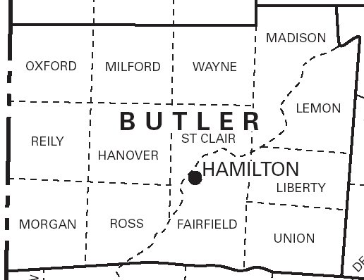
McBride's 1836 Plat Maps...
1 Several townships contain duplicate section numbers. This is due to the fact that a physical township won't always correspond to a political township. 2 Union Township was officially renamed West Chester Township in 2000. High resolution versions of these maps are available here.
|
Acknowledgements... McBride's 1836 Plat Maps were obtained from the Butler County Engineer's Office by Bob McMaken in his capacity as a volunteer at the Butler County Records Center & Archives. Index to McBride's 1836 Plat Map... This index to McBride's 1836 Plat Map was created from the maps themselves, with help from McBride's 1834 county-wide re-appraisal and Ancestry.com's 1830 and 1840 censuses. The 1834 re-appraisal was used to identify owners of some unnamed parcels shown on the 1836 map and to help with spelling. Any names that came exclusively from the 1834 re-appraisal are noted as such in the comment column. Ancestry.com's censuses were also used to confirm spellings. Since spelling could be an issue, try entering just the first letter of the last name, or not entering a last name at all (you must select a township if you leave the last name empty). McBride's map does not identify all landowners, especially in congested urban areas like Oxford, Hamilton, and Middletown. So if you don't find who you are looking for on the map or in this index, you are urged to consult McBride's 1834 county-wide re-appraisal for more detail. |